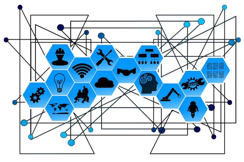
In an ever more connected world, Esri a global provider of geo-spatial and analytical software is about to embark on a new journey to help organisations understand and analyse vast amounts of Internet of Things (IoT) big data through location intelligence.
Source: Geospatial technology will be at the heart of the IoT Big Data analysis
As we know, the digital transformation of people’s lives from recent events has become a relentless force, says Richard Stevenson, telco leadat Esri UK. Network connectivity is both extending its geographic reach and multiplying as 5G and FTTP networks become available in an increasing number of places. The computational power of devices continues to increase, cloud computing has become more cost effective and IoT devices themselves get smaller and smaller.
Advances in sensor technology are turning everyday objects into sources of data. The combination of these trends has led us to a new place. It is now possible for a network of physical objects (vehicles, buildings, infrastructure, equipment of all shapes and types) to collect and exchange data and to work together. This enables devices, sensors and systems to operate autonomously in pursuit of goals and objectives set by the human architects of the system.
Participating in the data market
Every data stream created in the IoT will be of value to a particular audience or audiences. For example, data captured from a smart chip on vehicles travelling along a motorway could be used to create a range of anonymised datasets; for example, traffic volumes by time of day, origin/destination routes or shopping centre catchments.
These can be packaged and priced to meet the needs of specific audiences. But the data becomes more valuable if combined with other datasets such as weather feeds or foot traffic in retail centres, enabling, say, a retailer to forecast customer demand.
IoT data consortiums
We predict the emergence of IoT data consortiums offering multiple data services using mix ’n’ match aggregated data feeds. This business model is widely used at present to provide syndicated services such as online entertainment listings linked to ticket sales.
It will enable non-competing IoT service vendors to leverage the value of their data and to spread the cost of collating data sets over a large number of consumers. A core source of value add for these organisations will be their ability to complement straightforward IT processing expertise with a platform that supports the geographical and time-based analysis of data as well as providing regulatory, legal and consumer advice alongside real-time pricing and billing services.
How location intelligence transforms raw data into actionable intelligence
Knowing where something is located is a critical piece of contextual information that is integral to the successful function of the IoT. Take the example of road safety systems in a connected car. When the car senses slippery conditions its road traction systems respond within a fraction of a second to keep it on the road. It does that automatically, without needing to know where it is. However, that knowledge about a slippery road is immensely valuable to other road users if they too are likely to come across the adverse conditions.
Location data can be used in three main ways:
- Descriptive analytics – ‘What happened?’
Data mining and analysis gives us insight into past history. By transmitting the location of the hazard, the car can warn other cars in that area of the risk.
- Predictive analytics – ‘What will happen?’
Use of modelling techniques to forecast the future. By collecting historical data from millions of vehicles over time and relating to weather data by location, the system can predict where and when slippery conditions will occur and can warn cars before the risk is even encountered.
- Prescriptive analytics – ‘What should be done?’
Scenario modelling and simulation to evaluate the impact of remedies. By modelling the impact of alternative solutions on the locations of interest we can rank alternative solutions based on success criteria and choose the option that minimises or eradicates the hazard.
Geo-analytics within the system
Geo-analytics enables us to answer questions which have in the past been difficult to answer, either because of a lack of data or because of a lack of computational power.
Questions like:
• What is happening in this area?

- APP Remote Control: Easily control your home...
- Voice Control: Smart plugs that work with Google...
- Easy Setup: It takes less than two minutes for the...
- Other Features: Diverse timer scheduling...
- 7*24 Customer Service: If you encounter any issues...

- BETTER INSIDE AND OUT – Entertainment is more...
- VIBRANT SIGHTS, FULL SOUND – Content on Prime...
- SMART HOME, SIMPLIFIED – Pair and control...
- STAY IN THE LOOP – Video call hands-free using...
- SHOW OFF YOUR GOOD TIMES – Amazon Photos turns...
Last update on 2024-04-05 / Affiliate links / Images from Amazon Product Advertising API
• What other things are close by?
• In what other places is a similar situation present?
• Where have we seen this before?
• Where might we see this in the future?
Traditional Geographic Information Systems (GIS) use maps to present geographic information in a way humans can understand. Geographic information is central to the IoT, but the map’s primary role is to help people when visualising the data. Within the system, sophisticated spatial queries and geo-processing algorithms built in to IoT platforms can connect data that was previously unconnected. This gives geospatial information a central role in the IoT data market described above.
For real-time data feeds to deliver value they must be based on a consistent geographic base and be time synchronised in order to feed predictive analytics tools. Presenting the information on a map makes it easy for people to use and to identify visual patterns which allow decision makers to increase sales or to control costs more effectively. The ability to handle large scale data sets in the Cloud, to present data geographically and to provide the tools for analysis are all ways in which value can be added to raw data.
Esri is talking this a step further and has this month launched ArcGIS Velocity, a new real-time and big data capability for Esri’s geospatial cloud. It enables users to ingest, visualise, analyse, store, and act upon observation data from sensors and Internet of Things devices.
Connect virtually any type of streaming data
ArcGIS Velocity offers both real-time and big data analysis, with tools for geofencing, incident detection, and trend assessment. Real-time event data can be filtered, processed, and sent to multiple destinations, allowing you to connect virtually any type of streaming data and automatically alert personnel when specified conditions occur.

- Smart Water Detector: Our water detector alarm...
- Quick & Accurate Leak Detection: Our WWD Water...
- All-Orientation Operation: Our water sensor alarm...
- Compact & Easy to Install: Our wireless water...
- Durable & Long-lasting: is made to last, with a...

- Super Durability】10000+ flex life and double...
- Gold-plated connectors and aluminum
- ★ Surround Sound Capability ★ Truely supports...
- ★ Multi-device support ★ Compatible with...
- Super Durability】10000+ flex life and double...
- Gold-plated connectors and aluminum
- ★ Surround Sound Capability ★ Truely supports...
- ★ Multi-device support ★ Compatible with...
Last update on 2024-04-05 / Affiliate links / Images from Amazon Product Advertising API
Users can also design analytic models to process high-volume historical data and gain insights into patterns, trends, and anomalies.
Key capabilities include:
- Connect: Connect to real-time, streaming IoT data from multiple feeds and visualise directly in maps.
- Analyse: Speed up your analysis and gain answers faster when you set up analytical models in the cloud.
- Alert and actuate: Act on this geo-spatial analysis by sharing the results and alert stakeholders when it matters.
This will transform organisations to truly understand, in real time, spatial events as they unfold and offer descriptive predictive & prescriptive analytics to inform operations, as well as enhanced business intelligence.
The author is Richard Stevenson, telco lead, Esri UK.